How to tell the tourists in a city from the locals? Potentially reliable indicators include the language they speak, the terms they use, the way they dress, the way they walk, and whether they're standing in the middle of the sidewalk squinting at a map. But few factors draw the line between tourist and local more starkly than where they go and don't go: no matter the city, one will sooner or later hear talk of places locals know that tourists don't, places locals don't go because tourists do know about them, places tourists go when they want to act like locals, places locals go when they want to act like tourists, and so on.
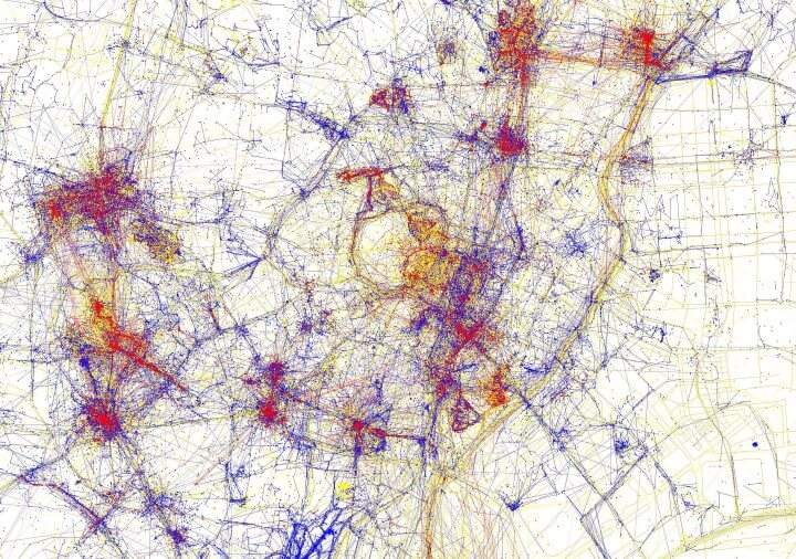
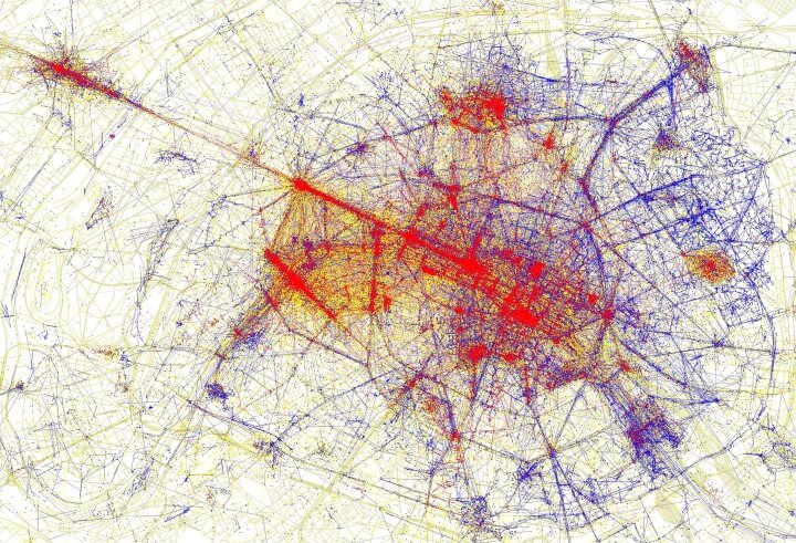
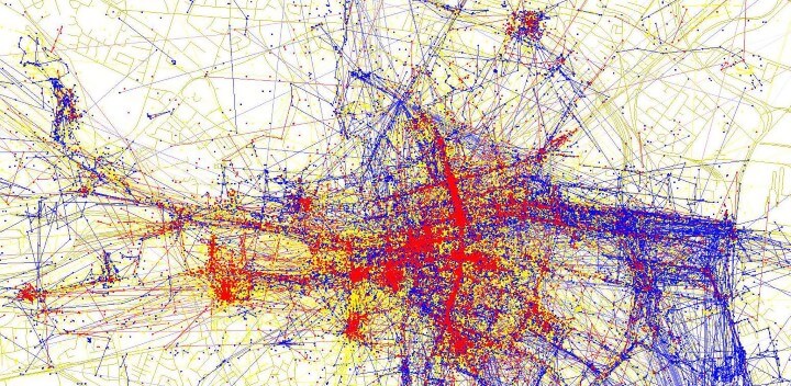
In his project "Tourists and Locals," Eric Fischer has found one way of quantifying this great divide: where do the members of each group take the photos they upload to the internet? You can view the results in 136 different city maps or explore a whole world map, both of which use the same color coding: "The red bits indicate photos taken by tourists," says Brilliant Maps, "while the blue bits indicate photos taken by locals and the yellow bits might be either." Using "MapBox and Twitter data from Gnip to create the maps," Fischer defined locals as "those who tweeted from the same location for at least a month" and tourists as "those who were considered local in another city but were tweeting in a different location."
Here, from the top of the post down, we have Fischer's maps of Paris, Tokyo, Dublin, and San Francisco, all cities with varying degrees of overlap between the realm of the local and that of the tourist. Parisian attractions like the Parc de Belleville and the Bassin de la Villette show a relatively healthy tourist-local balance, whereas outsiders dominate in places like La Défense with its highly photographable skyscrapers, and of course the Louvre (to say nothing of the red-saturated Versailles, not pictured in this segment of the map). Compare that with Tokyo, which of course has world-famous spots — the quaintly historic Asakusa, the sublimely urban Shibuya Crossing — but whose form doesn't encourage quite as strict a physical separation of tourist and local.
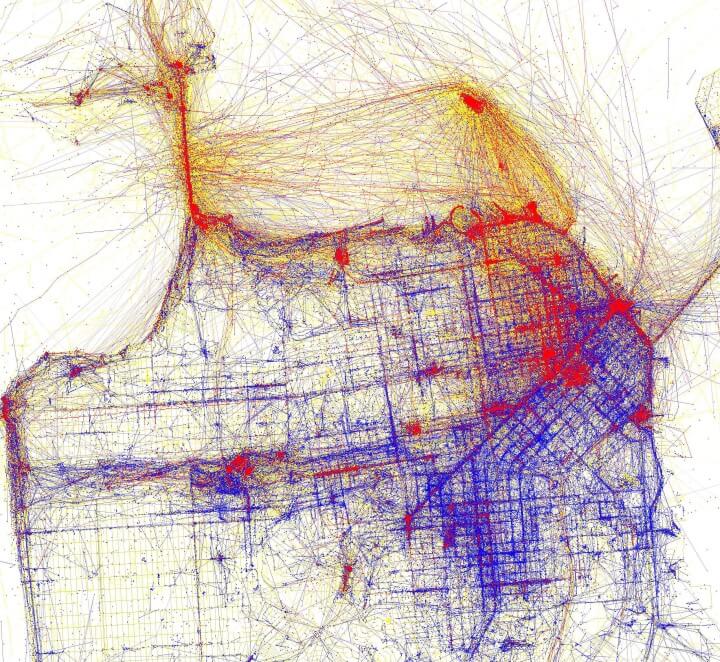
The path a tourist takes through Dublin might overlap a great deal with the one Leopold Bloom took on June 16, 1904, but less so with the paths an average Dubliner takes in the 2010s. The Irish capital also offers a host of must-sees apart from the Ulysses tour — the Guinness Storehouse, Trinity College's Old Library, home of The Book of Kells— but visitors would do well to follow the example of Dublin's locals and get a bit more distance from the city center. They could do the same in San Francisco, a city of iconic tourist attractions on which, before the tech boom, its very survival seemed to depend. But do true travelers, as opposed to tourists, need this kind of data processing and information design to know their time would be better spent somewhere other than Fisherman's Wharf?
See 136 different city maps here.
via Brilliant Maps
Related Content:
Take a Visual Journey Through 181 Years of Street Photography (1838-2019)
The Shifting Power of the World’s Largest Cities Visualized Over 4,000 Years (2050 BC-2050 AD)
How Leonardo da Vinci Drew an Accurate Satellite Map of an Italian City (1502)
James Joyce’s Dublin Captured in Vintage Photos from 1897 to 1904
An Online Gallery of Over 900,000 Breathtaking Photos of Historic New York City
A Wonderful Archive of Historic Transit Maps: Expressive Art Meets Precise Graphic Design
Based in Seoul, Colin Marshall writes and broadcasts on cities, language, and culture. His projects include the book The Stateless City: a Walk through 21st-Century Los Angeles and the video series The City in Cinema. Follow him on Twitter at @colinmarshall, on Facebook, or on Instagram.
136 Maps Reveal Where Tourists & Locals Take Photos in Major Cities Across the Globe is a post from: Open Culture. Follow us on Facebook, Twitter, and Google Plus, or get our Daily Email. And don't miss our big collections of Free Online Courses, Free Online Movies, Free eBooks, Free Audio Books, Free Foreign Language Lessons, and MOOCs.


from Open Culture http://bit.ly/2JYZp1c
via Ilumina
Comments
Post a Comment